À propos du livre
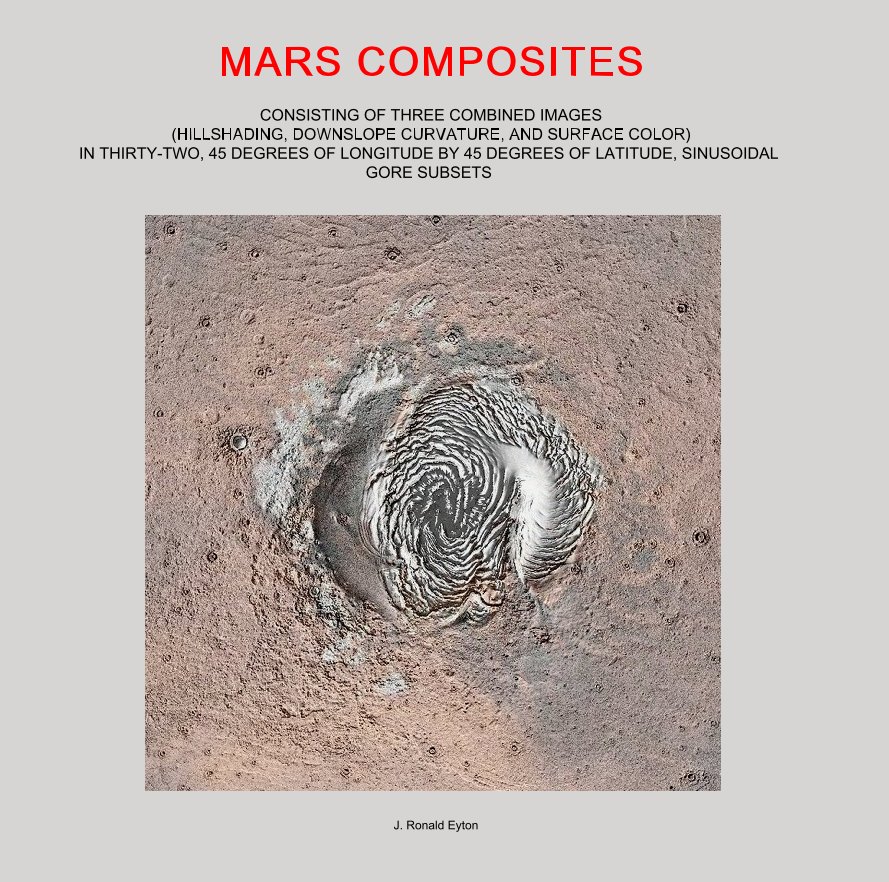
This mini-atlas consists of thirty-two 10 inch by 10 inch images of Mars each covering an area contained in a 45 degrees of longitude by 45 degrees of latitude window. The 32 pixel/degree resolution MOLA (Mars Orbital Laser Altimeter) MEGDR grid containing 5760 rows by 11520 columns of elevation data was first used to generate a hillshaded cylindrical map projection image. This image was combined with a down-slope curvature image also derived from the MEGDR grid of elevations to add fine landform detail. A final surface color image was added to the set. This set was then subdivided into the 45 degree by 45 degree plates that comprise this pictorial atlas.
Caractéristiques et détails
- Catégorie principale: Livres d'art et de photographie
-
Format choisi: Grand carré, 30×30 cm
# de pages: 46 - Date de publication: juin 03, 2016
- Langue English
Voir plus
